How Utility Locating Improves Long-Term Project Performance
Big project problems do not always start with big mistakes.
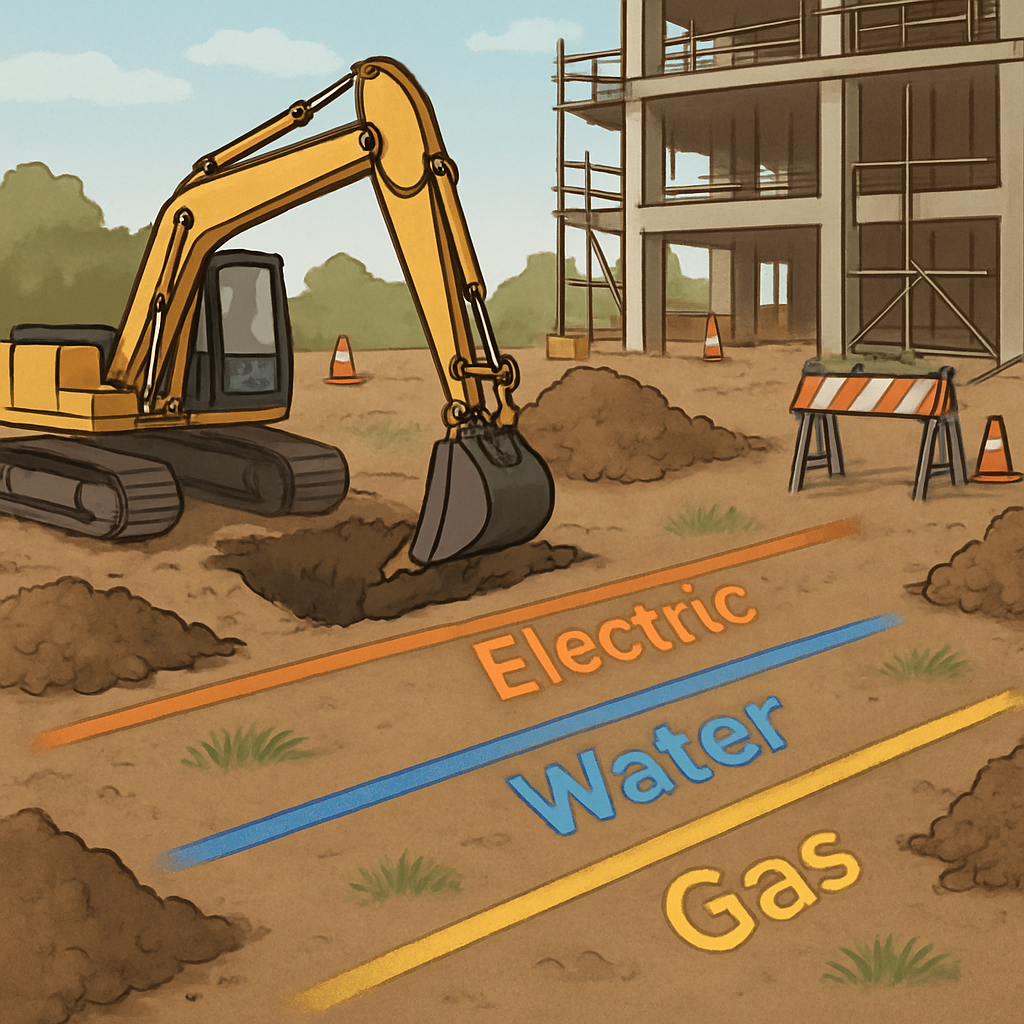
Quite often, they start underground.
One missed cable.
One outdated drawing.
One stormwater line nobody picked up.
That is all it takes to cause delays, rework, shutdowns, and rising costs across a job.
That is why utility locating matters so much. When teams know what is below the surface before excavation starts, they make better decisions early. They reduce risk, protect the programme, and avoid expensive surprises later.
In simple terms, good locating helps projects run better for longer.
In this article, we will look at how utility locating helps with:
- schedule control
- safer excavation
- asset protection
- environmental risk reduction
- spill planning
- compliance and reporting
- long-term project performance
Why utility locating matters before digging starts
A lot of site issues begin before the first machine even arrives.
They begin when teams:
- rely only on old drawings
- assume records are accurate
- overlook undocumented services
- rush into excavation without proper checks
That is where risk builds.
Utility locating gives project teams a clearer picture of what is underground. That includes known services, unknown assets, and crowded utility corridors that may not appear on plans.
With that information early, teams can:
- sequence works more safely
- plan trenching with more confidence
- avoid unnecessary shutdowns
- reduce reactive decisions later
The simple takeaway
Better underground visibility leads to better project control.
How GPR and EML improve locating accuracy
No single locating method finds everything.
That is why experienced teams often use both:
- GPR (Ground Penetrating Radar)
- EML (Electromagnetic Locating)
Each one does a different job. Together, they give a stronger picture of what sits below ground.
GPR helps find what drawings often miss
GPR uses radar signals to detect buried objects and changes in subsurface materials.
It is especially useful for finding:
- non-metallic pipes
- unknown buried objects
- voids
- hidden structures
- changes in ground conditions
This matters on sites with poor records or older infrastructure.
For example, a non-metallic pipe may not show up with standard locating alone. If that pipe gets missed during planning, crews may only find it once excavation begins. By then, the delay has already started.
Why it matters
GPR helps reduce blind spots before they become field problems.
EML helps trace conductive services quickly
EML is used to trace conductive underground services such as:
- power cables
- metallic pipes
- telecom lines
- tracer wires
It works well in live and congested service corridors, where speed and accuracy really matter.
If crews know exactly where conductive assets run, they can:
- adjust excavation methods
- avoid strike zones
- protect service continuity
- reduce emergency callouts
Why it matters
EML helps turn uncertainty into a workable excavation plan.
Why using both methods works better
GPR and EML are strongest when used together.
That is because:
- GPR can detect some assets EML may miss
- EML can confirm and trace conductive services clearly
- combined results reduce gaps in detection
- teams can plan with more confidence
On busy civil and construction sites, that extra confidence matters.
It helps teams make better decisions about:
- trench alignment
- access routes
- verification points
- high-risk excavation zones
The simple takeaway
Better locating data means fewer surprises later.
Early locating helps reduce rework and delays
Rework is expensive.
It drains labour.
It disrupts trades.
It eats into margins fast.
And often, it starts with poor underground visibility.
When utility locating happens early, teams can refine plans before excavation begins. That means trench paths, access points, and excavation methods can be adjusted before plant is mobilised.
A common site example
Imagine this:
A crew starts trenching using old drawings.
Partway through the dig, they expose an undocumented service.
Suddenly:
- work stops
- supervisors reassess the area
- redesign begins
- plant sits idle
- other trades lose access
Now compare that with a site that completed locating early.
The service is identified before work begins. The trench alignment changes early. The job keeps moving.
That is not just safer. It is better for programme stability.
Why it matters
Prevention is almost always cheaper than fixing the problem in the field.
Preventing asset strikes protects more than the day’s work
An asset strike creates instant disruption.
But the long-term damage can be worse.
A damaged cable, water line, gas pipe, or communications conduit can lead to:
- emergency shutdowns
- safety incidents
- repair costs
- client frustration
- programme delays
- regulatory pressure
Early locating lowers that risk because crews are not digging blind.
They know:
- where services are likely to sit
- where verification is needed
- where non-destructive exposure may be safer
- where excavation methods need to change
This also protects infrastructure over the long term. Even when a damaged service is repaired, hidden weakness or reduced reliability can remain.
Why it matters
Avoiding asset damage protects both today’s project and tomorrow’s reputation.
How utility locating helps minimise water and soil contamination
Service strikes do not only damage infrastructure.
They can also create environmental issues.
If a service is damaged near:
- stormwater assets
- washdown areas
- industrial zones
- contaminated land
- drainage corridors
the result may be more than a repair. It may lead to spilled liquids, sediment spread, or contaminated material entering the ground.
Utility locating helps minimise water and soil contamination by reducing the chance of accidental damage during excavation.
When crews know where critical services and drainage links sit, they can:
- avoid ruptures
- reduce over-dig
- limit unnecessary disturbance
- excavate with tighter control
Why this matters
Contamination spreads fast once it reaches drains, trenches, or low points.
A small underground mistake can become a much larger cleanup.
The simple takeaway
Better locating supports cleaner excavation and lower remediation risk.
Utility locating also supports proactive spill management
Spill planning often focuses on:
- bunding
- storage areas
- spill kits
- drain protection
Those things matter. But underground risk should be part of the plan too.
If a buried asset strike could release product, slurry, or contaminated water, then utility locating becomes part of spill prevention.
Early locating helps teams identify:
- where spills may start
- where they may travel
- which areas need tighter controls
- where spill response equipment should be placed
A practical example
Say a project has a service corridor near:
- fuel handling zones
- stormwater pits
- drainage infrastructure
If that corridor is mapped early, the team can:
- excavate more carefully
- place spill kits nearby
- prepare drain isolation measures
- reduce the chance of escalation
Without that information, controls may only be added after an incident begins.
Why it matters
Good spill management starts before the ground is opened.
Utility mapping improves incident response planning
An incident response plan only works if it reflects real site conditions.
If underground assets are poorly understood, response teams may struggle during an emergency. That can slow decisions, increase disruption, and make the situation worse.
Utility mapping improves incident response planning by showing where:
- critical services run
- drains and pits sit
- high-risk underground areas exist
- access routes may be limited
That gives teams a more realistic response plan before work starts.
It helps with incidents involving:
- fuel
- slurry
- contaminated runoff
- damaged services
- drainage impacts
Why it matters
When teams already understand the underground layout, they can respond faster and with more control.
Utility locating supports stronger compliance
Good compliance is not only about reacting well after something goes wrong.
It is also about showing that the site took practical steps to prevent avoidable harm.
Utility locating helps support that position because it shows early risk identification and informed planning.
When locating data feeds into excavation planning, projects can document:
- what underground risks were identified
- how those risks were managed
- why certain controls were used
- why excavation methods were adjusted
That becomes especially important if an incident later leads to environmental harm.
Clients and regulators may ask:
- What did the site know?
- What steps were taken before excavation?
- Was the risk properly assessed?
Accurate locating records help answer those questions clearly.
For practical guidance, Safe Work Australia provides information on excavation and workplace safety: https://www.safeworkaustralia.gov.au/
For environmental obligations and pollution reporting in New South Wales, see the NSW EPA: https://www.epa.nsw.gov.au/
The simple takeaway
Accurate locating does not replace compliance, but it makes compliance easier to support.
Better underground planning protects site reputation
Reputation is built over time.
And often, it is built on how well a site handles risk.
Projects that avoid service strikes, major delays, and environmental incidents tend to earn trust. They look organised, well-managed, and prepared.
When utility locating is done early and properly, projects usually have:
- fewer surprises
- smoother coordination
- less visible disruption
- stronger client confidence
- fewer complaints and shutdowns
That matters now, but it also matters later.
A contractor known for careful underground risk management may benefit from:
- stronger tender confidence
- better client trust
- smoother mobilisation
- improved long-term credibility
Why it matters
Utility locating is not just a technical service. It also supports long-term business performance.
What project teams should do before excavation begins
If you want utility locating to improve long-term project performance, start early and use the information properly.
Do not treat locating like a last-minute box to tick.
A practical checklist
Before excavation begins, teams should:
- review available service records
- use both GPR and EML where needed
- verify high-risk areas before trenching or bulk excavation
- align utility mapping with spill planning
- check drain protection around sensitive zones
- update crews on located services
- record locating outcomes clearly for future reference
Why this matters
The value is not only in detection.
The value comes from using the information to shape real decisions on site.
Final thoughts
Utility locating improves long-term project performance because it reduces uncertainty before excavation creates risk.
When teams locate early, they can:
- avoid rework
- reduce delays
- prevent asset strikes
- protect schedules
- support safer excavation
- lower environmental risk
- strengthen compliance
For Tasman Excavations, the benefit is practical and clear. Accurate locating supports proactive spill management, stronger incident response planning, and better control across complex sites.
If you want better long-term project outcomes, start below ground.
Review buried asset risk early.
Use proven locating methods.
And make underground information part of every major excavation decision.